The Guide to Operational Planning Feasibility: Mastering Zoning with AI
1. Why Manual Zoning Analysis Hinders Architecture Firm Profitability
Every real estate project—whether it's new multi-family housing, a residential extension, or a renovation in a dense urban environment—is subject to local planning rules. Whether a municipality depends on a Local Plan, Zoning Bylaws, or National Building Codes, the first phase always involves a rigorous feasibility study.
Traditionally, this pre-design phase requires designers, architects, and project managers to manually re-read dense regulatory documents, often ranging from 150 to over 400 pages. A simple reading error regarding Alignment with Public Roads or Boundary Setbacks can lead to an outright rejection of the building permit or third-party appeals, resulting in major financial losses and construction delays of several months.
2. Key Planning Indicators Automated by Klysia
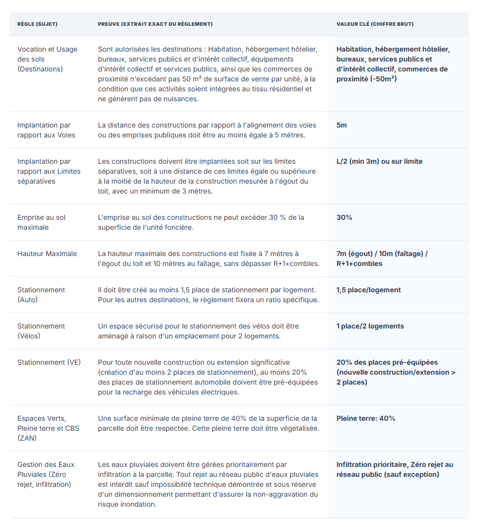
Our AI engine has been specifically configured and trained to identify and extract the structural variables essential for drafting the maximum building envelope:
- Site Coverage Ratio (SCR/CES): Klysia immediately identifies the maximum allowable footprint percentages for your zone, saving you from tedious calculations of unbuilt surfaces and minimum green space requirements.
- Building Massing and Max Height: Whether measured at the ridge, the eaves, or expressed in number of stories (G+2, G+3 with attic), the algorithm segments the literal data to extract the exact numerical constraint.
- Setbacks and Prospect: The analysis of alignment rules or setback calculations based on formulas like
H = LorH = L / 2is immediately automated to define mandatory minimum distances. - Parking and Open Space: Extraction of obligations per housing unit, per square foot of floor area, and soil permeability requirements.
3. How to Optimize Your Planning Applications?
The time savings provided by AI-assisted analysis is not limited to speed of execution. The real asset lies in the legal securing of the file. Planning department officers analyze permit requests based strictly on literal compliance with written regulations and zoning maps.
By providing your client, the engineering office, or the local council with a clear urban feasibility report, supported by legal proof citations extracted by Klysia, you drastically reduce the risk of requests for additional information, streamline interactions with heritage officers, and accelerate the approval of your administrative authorizations.
4. Workflow Integration: From GIS Portals to 3D Models
For a feasibility study to be effective, it must integrate seamlessly into your firm's graphic production workflow. Klysia bridges the gap between state geographic data platforms (GIS) and your traditional CAD/BIM software.
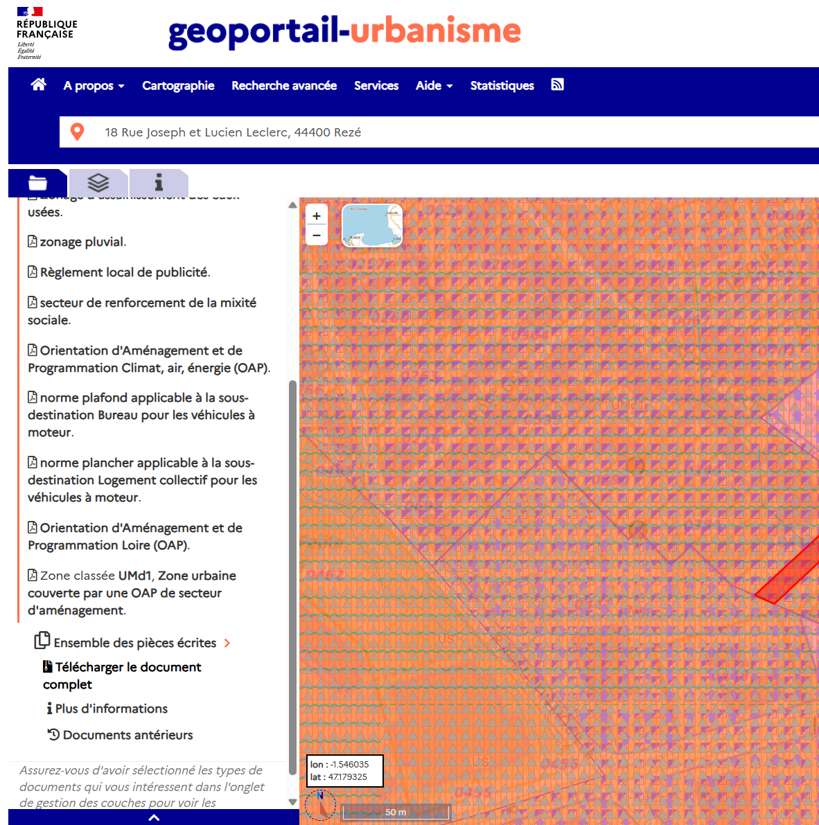
Entering the address allows you to first isolate the plot graphically and verify the zone on the planning maps, and then apply Klysia's language model to the corresponding written document. You move from raw regulatory data to a site plan sketch in record time, freeing up pure design time to leverage your architectural expertise and refine the relationship with your client.