Landscape Assessment & Planning Permits

Perfect photomontages for your permits in record time.

Visual impact integration is the key to winning over planning boards and local authorities. Stop wasting hours on Photoshop. Import your site photos and 3D models, and let Klysia orchestrate chromatic blending, lighting, and vegetation.

Start my visual integration

Strict compliance with professional planning standards. 100% online solution.

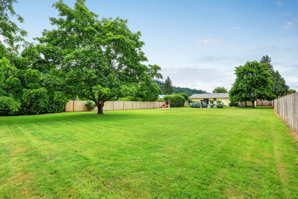
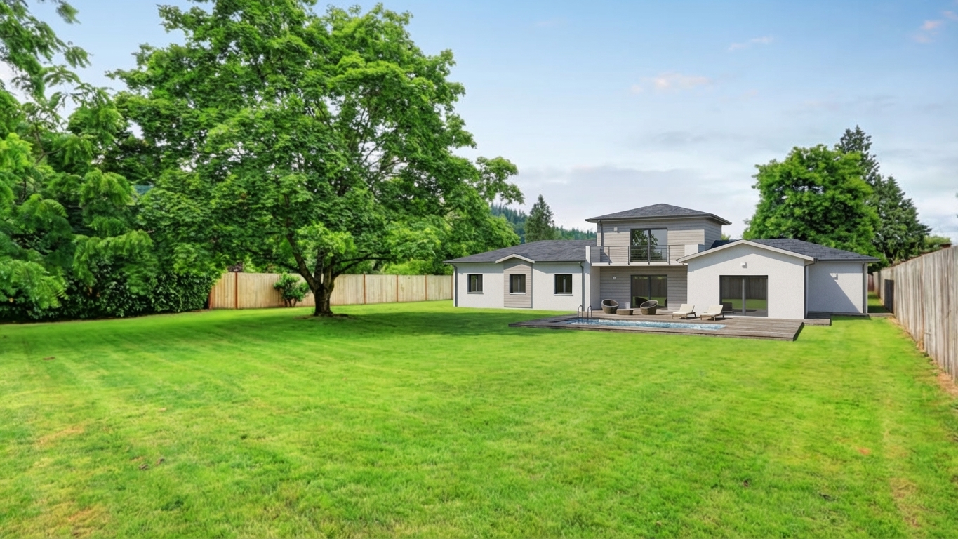
Perspective alignment and AI fusion interface between real environment and 3D model

Intelligent 3D Fusion & Shadow Harmonization

Klysia's AI goes beyond simple cutouts or image layering. Our algorithm analyzes sun path, exposure, and diffuse colorimetry from your original photography to adjust the materiality of your project in real-time.

The result is immediate: your building integrates organically into its environment. Ground shadows, impact on neighboring structures, and depth of field are perfectly preserved without manual color correction.

Realistic Landscaping & Dynamic Site Dressing

To create a flawless visual impact assessment, the treatment of the immediate landscape surroundings matters as much as the architectural model itself. Klysia includes an intelligent plant-layering tool that respects real textures.

  • AI Species Library: Rapid placement of high-stem trees, hedgerows, and realistic ornamental garden beds.
  • Automated Background Masking: The AI manages layer depth (existing vegetation that should remain in the foreground, walls, fences).
  • Zoning Compliance: Ensure that proposed plantings match local prescriptions defined in our Zoning Code Analysis module.
High definition final architectural photomontage for building permit submission

Validate Your Project with Planning Boards & Design Review Committees

Planning departments and review boards are constantly tightening requirements for future representations. An approximate integration or a distorted perspective suggests poor urban fit and lack of professional rigor.

With Klysia’s high-fidelity photomontages, you clearly demonstrate the semantic transition between the existing site and the future project. Drastically reduce RFIs (Requests for Information) or permit denials based on visual impact and neighborhood compatibility.

The Practical Guide to Visual Impact Assessments: Succeeding in Planning Applications via AI

1. The Crucial Role of Visual Integration in Planning Permissions

When preparing a **Building Permit** or **Planning Application** (whether for a residential home or a large-scale commercial project), graphic documentation of the proposed state is a strict legal requirement in most jurisdictions. These documents must present the architectural project in its immediate and distant environment, allowing planning officers and local municipalities to assess the visual impact of the future construction.

Traditionally, developing these visuals required advanced CGI skills and hours of meticulous work in image editing software. Designers had to manually match the perspective of their CAD model to a real photo, smooth transitions, correct light exposure, and manually integrate textures like brick, stucco, or cladding. A misaligned perspective or artificial texture rendering can discredit the entire schematic design and trigger requests for aesthetic modifications or project rejections.

2. How AI Preserves Structural Geometry vs. Abstract Generators

The rise of consumer-grade image generation models has created major confusion for many designers. Tools like Midjourney produce aesthetically pleasing images but are unusable for regulatory architecture because they suffer from "graphic hallucinations": they reinvent vanishing lines, ignore metric scales, and alter the very structure of the design.

The **Klysia Visual Studio** applies strict contour constraints (ControlNet). The algorithm relies on your base volumetric sketch or BIM export to lock in angles, window grids, and height profiles. The AI intervenes solely on the treatment of materials, light, and the surrounding landscape. It applies the exact texture requested (concrete, timber, metal, mineral finish) while respecting the architectural drawing to the millimeter, perfectly meeting the requirements for legal planning submissions.

3. Optimizing Green Space Integration According to Local Zoning Codes

Local **Zoning Codes** and **Urban Development Plans** do not only regulate building footprints; they also set rigorous requirements for green space ratios and site landscaping. Modern planning policy often mandates a specific number of high-stem trees per square meter and the exclusive use of local or indigenous plant species to preserve regional biodiversity.

Klysia's assistant simplifies this compliance by crossing graphic data with written site constraints. When dressing your photomontage, the tool suggests a palette of native trees, shrubs, and groundcovers. Furthermore, its plane-detection technology automatically separates the forest or urban background from foreground elements, facilitating the 3D landscape integration required by administrations for a stress-free approval process.

A Complete Software Ecosystem for Architects & Developers

Klysia simplifies and secures every contractual, visual, and administrative stage of your projects.

Frequently Asked Questions - Visual Integration & Photomontage

What 3D model formats and files should I upload to Klysia?
The imaging module does not require heavy or complex modeling files (like IFC, FBX, or OBJ). Simply take a high-resolution screenshot (JPEG or PNG) of your wireframe, clay model, or volumetric sketch from your design tool (Revit, SketchUp, Archicad, Rhino) and import it directly into our platform.
Are the generated integrations compliant for planning boards and municipalities?
Yes, absolutely. Planning departments and review boards penalize a lack of realism or major geometric distortions that prevent them from assessing the project's impact. Because Klysia preserves the real lines of your plans and adapts the shading path, you get high-fidelity photomontages that meet professional landscape assessment standards.
Can the AI mask large trees or existing buildings on the site?
Our tool includes advanced inpainting features (targeted retouching). If your site photo contains elements that need to disappear (fences to be demolished, dead trees, old structures), simply highlight the area with the brush tool. The AI will mask the element and seamlessly reconstruct the background before merging your new 3D model.

Master your visual impact assessments in a few clicks.

Boost your responsiveness during design phases and submit highly professional planning visuals.

Try Klysia for Free